The Pekoe Trail Stage 08: Norwood to Bogawantalawa
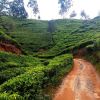
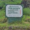
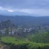
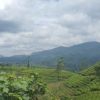
Length15.3 kmElevation gain629 mRoute typePoint to pointCheck out this 15.3-km point-to-point trail near Norwood, Nuwara Eliya. Generally considered a challenging route, it takes an average of 4 h 34 min to complete. This trail is great for backpacking, hiking, and walking, and it's unlikely you'll encounter many other people while exploring.Norwood is the gateway to the Bogawantalawa Valley. It is also a major crossroads deep in the tea country on the way from Hatton towards Maskeliya and Adam's Peak. It is also used by those wanting to take the backroads southbound towards Balangoda. The Bogawantalawa Valley is known as ‘the Golden Valley of Tea’. Considered to be one of the most beautiful tea-growing areas in the country, this scenic valley overlooks mist-shrouded, rolling hills and the mirror-still, picturesque Castlereagh Lake. To learn about the people living in the Bogawantalawa area, it is worth studying the most significant 19th-century female British photographer, Julia Margaret Cameron. This stage is divided into two very distinct parts. Approximately half of the route is a continuous and sometimes a little challenging ascent, and the second part of the trail is a continuous gentle descent towards Bogawantalawa. The trail leaves Norwood town pointing directly south. It’s a slow and at times challenging climb heading up towards the ridge that separates the Bogawantalawa Valley and the Maskeliya Valley. Some people wonder why The Pekoe Trail doesn’t take a more direct route through the bottom of the valley. The answer is simple: to deprive hikers from seeing the magnificent Maskeliya Valley would be a crime. Maskeliya is one of the most beautiful valleys in the tea country, home to Adam’s Peak, one of Sri Lanka’s most important sacred sites. The enshrined footprint at the summit is considered important to all religions, as it is considered the impression of Buddha, Adam, or Shiva. Near the start, the trail dog-legs sharply upwards. There are a few counterintuitive twists and turns until it crosses the Norwood – Upcot road. Soon after Norwood – Upcot road, there are switchbacks all the way to the top of the ridge. Wonderful views of the Maskeliya side come into view. The mountain on the other side of the lake is Adam’s Peak. Here, the track is on the Norwood Estate, a very well-known tea estate and factory, which can be seen onthe right. Up over the ridge, the trail descends back into the Bogawantalawa Valley. it is important to trust GPS as the path enters the most remote part of the route in this stage. Gone is the wide tea trail as it becomes a small and thin trail that leads to the upper divisions of the Kew Estate. A small Hindu shrine marks the correct path. To the left of the shrine looking up there are steps to follow. The route passes the Kew Estate Tea Factory. It continues east and pleasantly zig-zags down and around lovely tea fields. There isn’t much shade here. Eventually, a right turn runs into the main Norwood – Bog


